Grade
HillyDistance
20kmCycling
3-4 hoursThe Paritu to Mahanga Road, the main road between Mahia and Gisborne until about 1940, is now largely a forestry and farm track ... and an ideal mountain biking track. The trail offers dramatic views northeast along the Tairāwhiti coastline and south on the descent to Mahanga, a perfect destination beach for swimming, walking or shell collecting after the cycle ride.
Sunday is the best day for a cycle ride as log trucks may operate on the road on other days. Please note it is private land on either side of the road, and permission is only given to be on the road line.
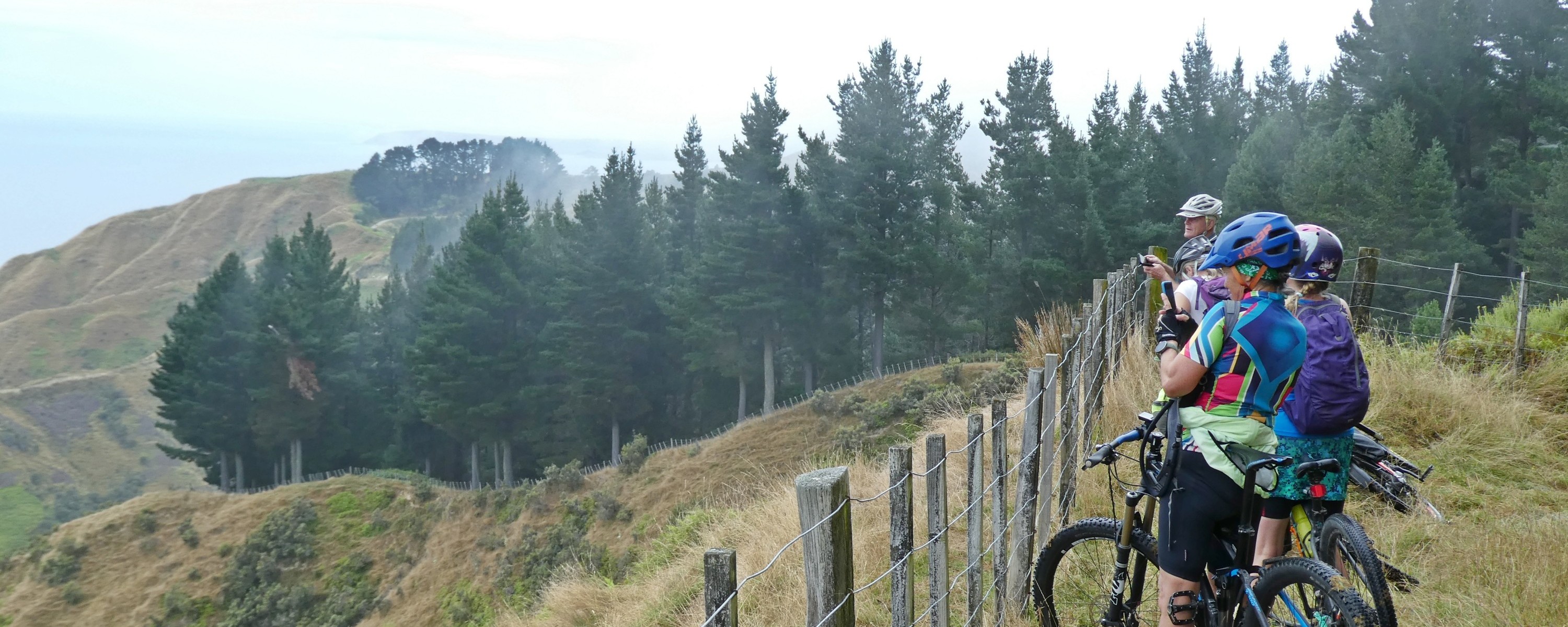
The old road branches off from Wharerata Road/SH2 about 3km on the Tūranga/Gisborne side of the Wharerata hills summit. The road follows the undulating ridgeline seen on the skyline south of Te Kurī a Pāoa (Young Nicks Head) when looking south from Titirangi/Kaiti Hill.
Start near the Wharerata Road/Paritu Road junction, at about 460m, for a mainly downhill ride to Mahanga.
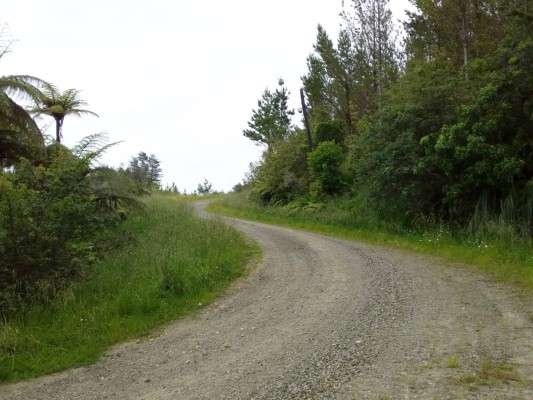
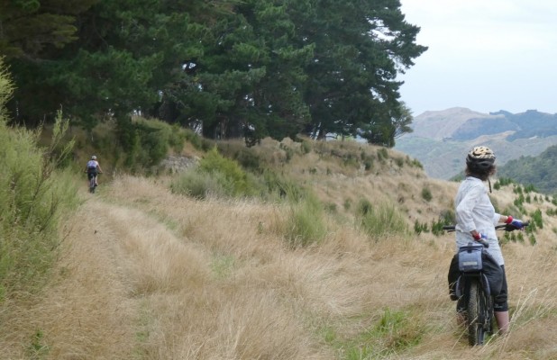
The first 8.5km of Paritu Road is loose, chunky gravel. But it's easy riding as long as you take the corners gently. When heading south, stop on the ridge's high points to look back towards Tūranganui a Kiwa for views along the Tairāwhiti coastline. Hikurangi maunga stands out on the skyline on a clear day. The Gisborne to Mahia Road was noted as including an unusually long section of road without a bridge. The road stays on a ridge for 22 miles.
At 8.5km from SH2, you'll meet a locked forestry gate. Here you will be directly above the Tikiwhata Railway Tunnel, which at 2,989m is the fifth longest railway tunnel in Aotearoa New Zealand. From here, Paritu Road turns left and becomes a rough farm track. You need to go through a farm gate to follow it. What appears to be the obvious road is a private forestry road constructed by Juken NZ Ltd - Kawakawa Road, which rejoins Paritu Road after 1.5km.
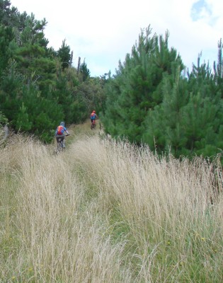
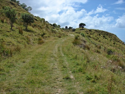
Follow Paritu Road along the farm track and rejoin the more well-used road at 10km where the road has a firm compacted gravel surface. In places, forest harvesting has meant new roads have been formed and the old road formation has been bypassed and is not obvious, being covered by windfallen trees, making the route not all straight forward to follow. At about 12km from SH2, push your bike up a short steep clay slope to leave the forestry road and re-find the old road formation, which continues as a grass track through pine trees.
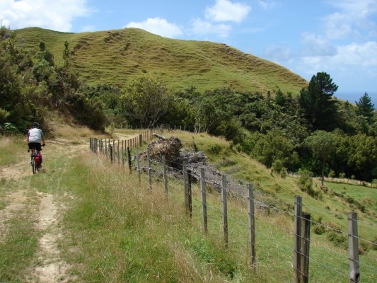
After another 500m, at a sharp bend in the road you will enter Te Au Station. Here there is a view towards Māhia, into the Kōpuawhara Valley, and inland to the high ridge of Whakapūnake. The railway line can be seen in the valley below. In February 1938, the flooded Kōpuawhara Stream swept through a railway construction camp at Kaingapipi below, and 21 people drowned.
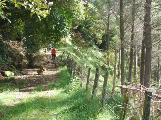
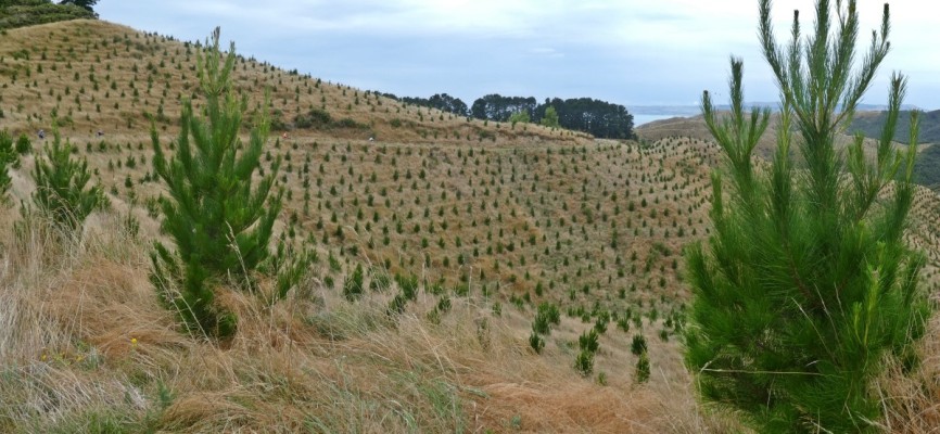
Te Au Station has become Te Au Forest, planted in 2021, and managed by PF Olsen Ltd. Paritu Road continues as a track through long grass with deep ruts which make cycling tricky. The ruts are easier to see in spring and early summer when deer and goats graze the grass, once kept short by sheep and cattle.
On the descent to Mahanga, the road becomes a steep dirt track with stream channels, bedrock slabs and slips before joining the more-used metalled section. Dramatic views of the rocky coastline are along the way.
Forest manager PF Olsen Ltd has installed a locked forestry gate across the road at the southern boundary of Te Au Station at Mahanga to restrict access by 4WD vehicles, but you can walk or push a bike around the ends of the gate.
History of the trail
In the first half of the 1900s, the Opoutama to Wharerata Road (including Paritu-Mahanga Road) became less used as the condition of the Gisborne to Wairoa Road via Morere improved, and along with it the connection to Opoutama via Nuhaka. The road was allocated ₤360 in the Public Works Estimates in Parliament in July 1938, indicating it was still being used as a road.
In April 1948, The Gisborne Herald described the road as the coast road between Opoutama and Wharerata. The road remained driveable, even in a family two-wheel drive car, in the 1960s.
Pine forest harvesting led to 12km of Paritu Road from SH2 being upgraded since the 1990s, when the Kawakawa Road deviation was built as a more stable route for log trucks.
Tips & Logistics
Juken NZ Ltd manages the plantation forest for Wharerata Forests Ltd, on the inland side of the northern part of Paritu Road. Access to Paritu Road from 8.5km to 10km needs to be requested from Wharerata Forests Ltd. Your request will be referred to Juken NZ Ltd regarding any forestry operations info@jnl.co.nz Wharerata Forest is well-used by deer and pig hunters. Goat cullers are employed at times by forest managers. It is advisable to wear a hi-vis cycling vest. Log trucks will likely be using the road except for Sundays.
Access for the Mahanga section of the road, which goes through Te Au Forest, needs to be requested from PF Olsen Ltd info@pfolsen.com
Cycling during a dry, summer period is recommended. The road surface through Te Au Forest can be soft or slippery, when wet.
A circuit cycle ride of 45 km is also popular, riding from Mahanga along Tunanui Road to Morere.