Grade
EasyDistance
13kmWalking
4 hoursCycling
1 hourSeasonal restrictions
Seasonal restrictions - the closure period for the lambing season varies with the DoC Walkways (Cooks Cove, Te Kuri Farm, Anaura Bay, and Otoko) being closed each year from 1 August until the start of Labour Weekend (late October), while Te Aratia Walkway and Mapiri Walkway are closed from July and reopen late September.
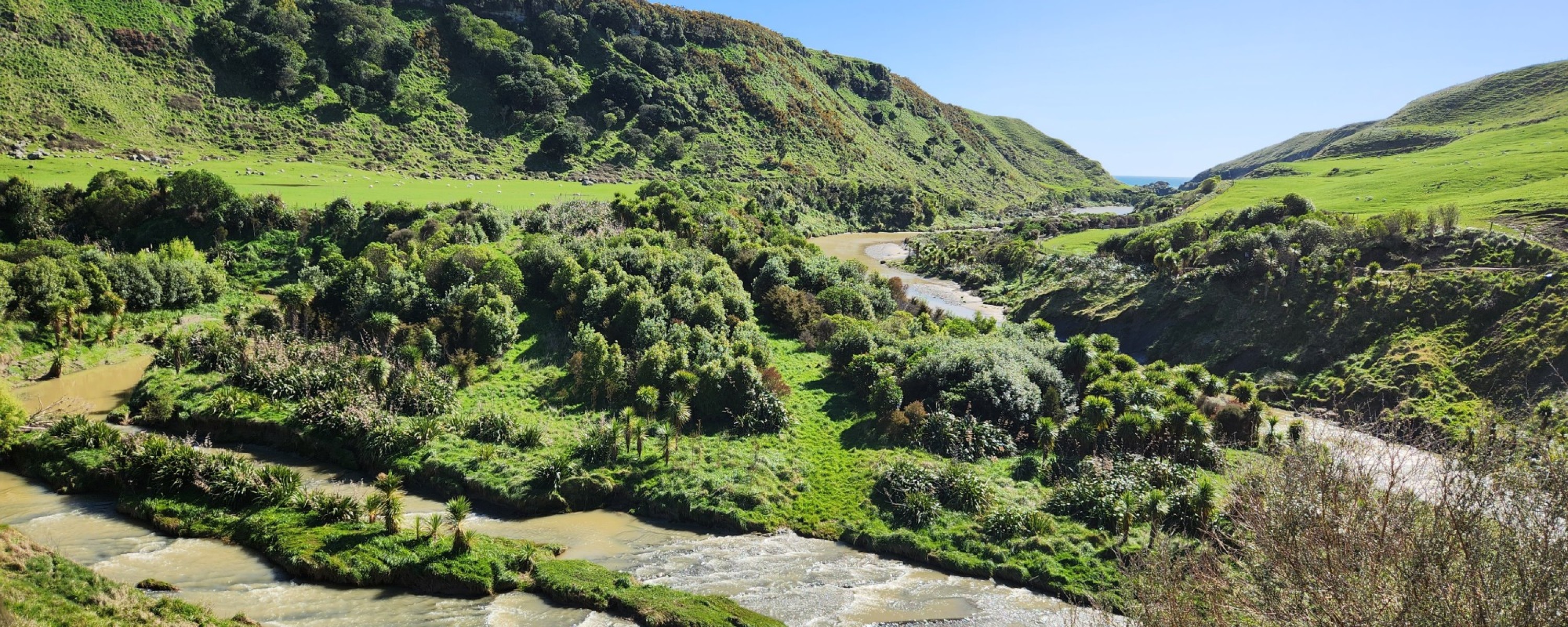
Te Aratia Walkway follows an ancient traditional ara (pathway), which connected Whangawehi Estuary to inland Māori settlements in the valley and was also used by people travelling up and down the coast. The idea of developing this walkway, an easement over private land across Māhia Peninsula, came from a desire to share the benefits of the large-scale Whangawehi catchment restoration project with the wider community.
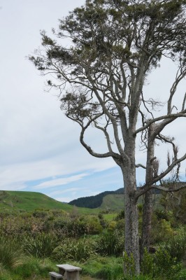
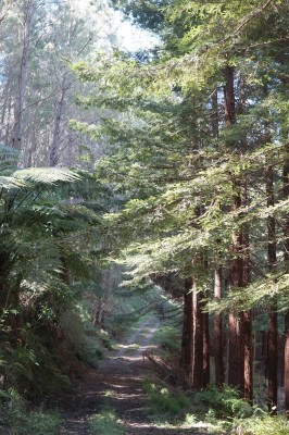
Te Aratia Walkway starts at sea level at the Whangawehi boat ramp. It follows the river and climbs gently through farmland to a picnic area. From there, the grade gets a little steeper through a commercial forestry block and beautiful native forest in the headwaters of the Whangawehi catchment before exiting on Kinikini Road at 140m. The views from here are breathtaking. A sidetrack, about 1.5km from the picnic area, leads to the boundary of Māhia Peninsula Scenic Reserve.
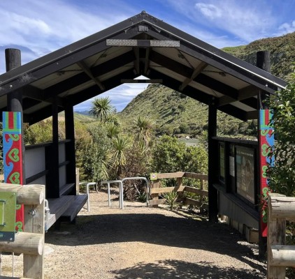
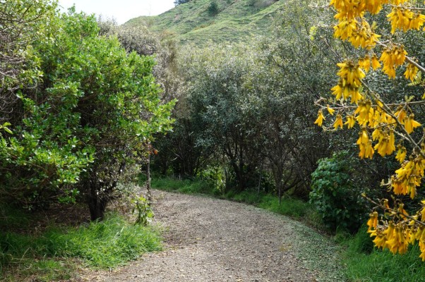
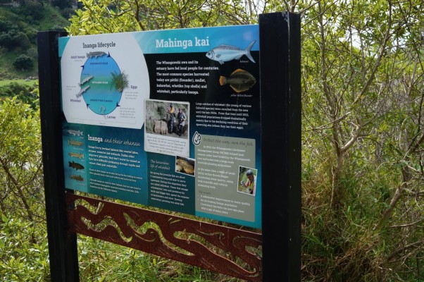
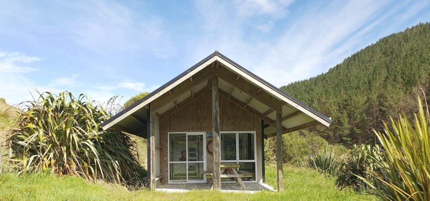
The information signboards along the trail are excellent and the tuna panels below the information signs emphasise the river restoration theme. The sturdy seats in places along the track are each unique and beautifully designed. In the lower section from Whangawehi Estuary the track surface is mostly compacted gravel. A shelter has been built near the stream crossing at the halfway point. After crossing the stream, the track is a dirt trail mostly under a varied plantation forest, and it can become muddy in wet conditions.
History of the trail
The Whangawehi Catchment Management Group (WCMG) was born in 2010 when the Wairoa District and Hawke's Bay Regional councils had to upgrade a wastewater system for the Māhia Beach township.
The Whangawehi community was worried the proposed settling ponds, to be located in the Whangawehi River headwaters, would harm the river, estuary and mahinga kai beds. Despite concerns, the local marae accepted the need for the ponds but asked for a community-driven large-scale restoration programme for their sacred awa to mitigate any ill effects from the treatment system and from other land uses. (From WCMG signboard on the trail.)
Since 2014, 250,000 native trees have been planted in the catchment, 150ha of riparian margins retired, and 30ha of bush blocks protected. In December 2020, the 13km Te Aratia Walkway was completed. Whangawehi Catchment Management Group website.
Ki te ora te wai, ka ora ai te katoa. If the water is healthy, then everything will survive.
Tips & Logistics
Te Aratia Walkway is 13km in one direction. If you are walking with just one car group of people, a good option is to walk from the Whangawehi Estuary to the shelter near the stream crossing, then back again. If you are part of a group with two car groups or more, part of the group could start at either end of the walkway and swap car keys when you meet on the track, or you could leave a vehicle at the opposite end before starting the walk.
The walkway can also be cycled, and keen cyclists can complete a round trip by including the road ride on Kinikini Road and Māhia East Coast Road, a circuit of 24km. The most attractive section of Te Aratia Walkway for cycling is from the Whangawehi Estuary to the shelter at the halfway point. This can be cycled as a "there and back" ride. The full trail is challenging to ride, especially the middle section which can be muddy, steep in places and with multiple creek crossings.