Grade
EasyDistance
8kmWalking
3 hoursCycling
30 minDuration does not include the steep Tatarahake Cliff Lookout Track.
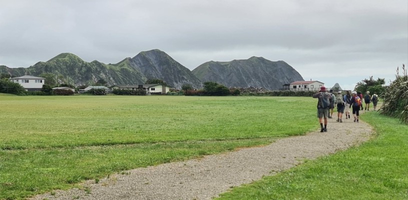
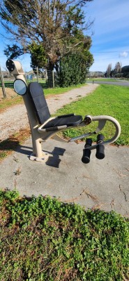
This easy trail around the Ūawa township consists of two loops, and encompasses views of the Ūawa River, town and beach. The pathway provides a safe off-road connection between Tolaga Bay Area School, the Tolaga Bay shops and amenities, skatepark, pumptrack, golf course and other activities, with Ūawanui a Ruamatua Awa, Tatarahake Beach, Tatarahake Cliff lookout, and Ūawa Parade as some of the points of interest. Look out for the fitness equipment installed along Forster Street, and do some resistance training on the way.
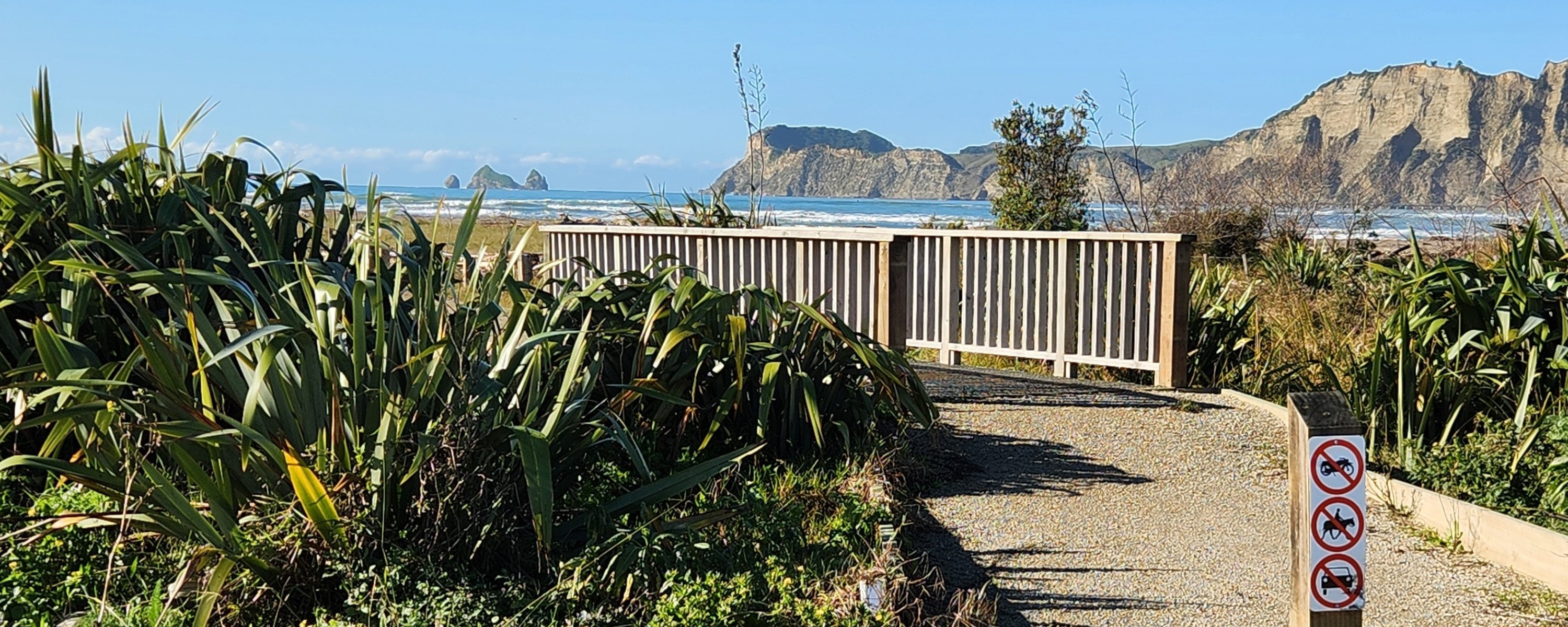
The trail is currently marked by bollards with “no motorbikes, horses or cars” signs. Before long there will be "wayfinding" trail signs added, with the trail name, Ūawa Cycle and Walkway, and arrows to assist with following the trail, as well as an entrance sign, with a trail map. The entrance sign will be at the corner of SH35/Cook Street and Monkhouse Street, where a blessing was held at the start of the trail construction.
Apart from a concrete path from Monkhouse Street to Tolaga Bay Area School, the 2.5m-3m wide trail comprises compacted fine gravel.
Near Tolaga Bay Area School, part of the trail has been damaged by recent high river levels. Native trees and flax line the trail towards the Ūawa River river mouth, with more planting work ongoing.
The cycle and walkway coastal circuit takes you close to the start of the climb up to the Tatarahake Cliff Lookout at the northern end of Tatarahake Beach. This is a 10-minute, steep climb including steps. The lookout provides outstanding views of Ūawa township, beach and river, Karaka Bay, inland cropping and farmland, and on a clear day, Hikurangi Maunga.


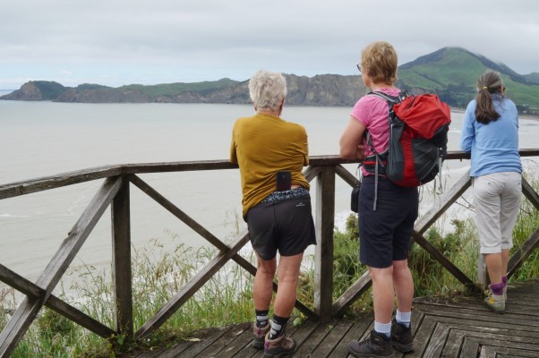
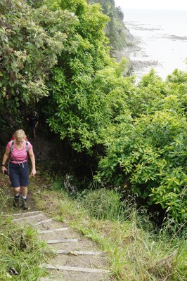
Tatarahake Cliff Lookout Track (Ernest Reeves Walkway) climbs from the beach to 50m. The Ūawa township trail is flat walking, close to sea and river level.
Trail fly-through
History of the trail
The Ūawa Cycle and Walkway Charitable Trust has been planning this trail for many years. Tolaga Bay Area School, Te Aitanga a Hauiti Centre of Excellence Trust, and Te Whare Hauora o Te Aitanga a Hauiti have supported the concept because of the wellbeing benefits of being more active.
While the township trail is complete the proposed Kaitawa Estuary Trail, connecting the township with the Tolaga Bay Wharf and Motor Camp, is still in the planning stage. This next stage of the trail will provide the community with a safe off-road connection between the wharf and the township, enabling school students living on the south side of the Ūawa River to get to school safely. The community plans to share their historical stories through signboards along the trail.
Tips & Logistics
The township and river part of the Ūawa Trail makes a lovely morning walk, or 20-30 minute cycle ride. The proposed Kaitawa Estuary stage of the trail will link the township to the wharf and motor camp via Hauiti Road. You can start the township trail loop walk at Monkhouse Street, and if you include the steep scramble up to the Tatarahake Cliff Lookout, at the northern end of Tolaga Bay (Tatarakahe) Beach, the walk is about 8.5km.