Grade
EasyDistance
5kmWalking
60 minCycling
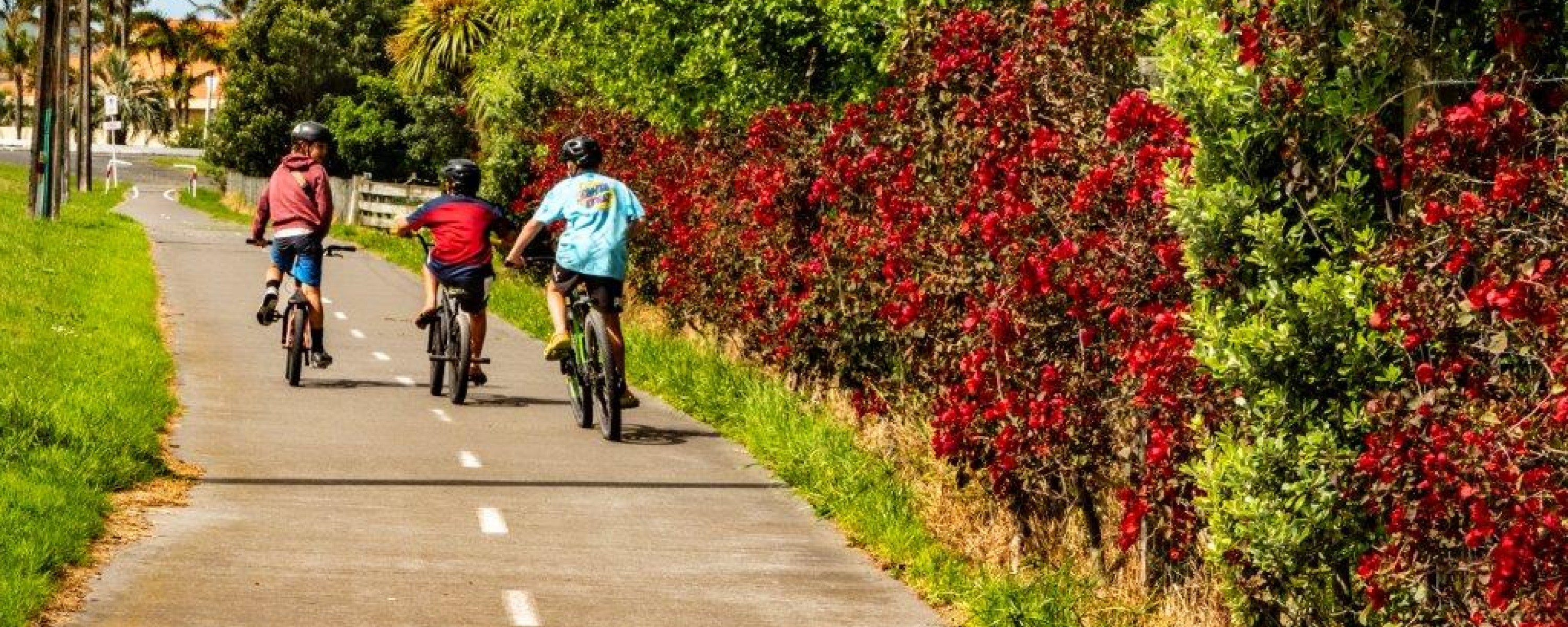
20 minThis trail connects Gisborne city with suburbs to the east, formally ending at the start of Wainui Beach on the east coast.
Wainui is an open beach with famous surf breaks and golden sands.
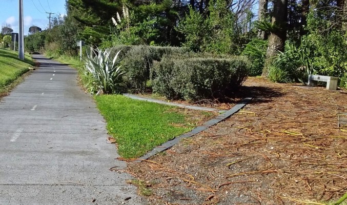
If travelling from Wainui Beach, the shared-path concrete trail goes from Murphy Road corner, near Stock Route surf break, past the Sponge Bay and Tamarau subdivisions, into Kaiti, past Kaiti School and the Kaiti Hub of shops beside SH35 and Wainui Road, to Crawford Road. The path then diverts away from the main road along a shared path, safely divided from traffic, to the Inner Harbour. It formally ends on the city side of the Gladstone Road Bridge.
Underpasses on both sides of Gladstone Road Bridge connect trail users to other destinations around the city. Some of these trails are covered in separate trail pages.
Trail fly-through
History of the trail
Wainui is known for its surf beach and the start of a journey up Highway 35 through the East Coast and around to Ōpōtiki in the Bay of Plenty.
In the late 1880s and early 20th century, horse-drawn coaches carried people and goods up the coast, often on beaches. In the early days of sheep farming, stock was driven along the coast. At Wainui, sheep and cattle would be driven from or to the beach at an access that became known as Stock Route. The Wainui-Tamarau Cycle and Walkway starts about 150m from this accessway. Stock would go from the coast to the freezing works, or live animals would be driven up the coast to new pastures.
The Wainui-Tamarau Trail was a long-held vision of many Wainui people, and spearheaded by former district councilor Muriel Jones. A sign bearing the name Muriel Jones Cycle and Walkway is sited in a rest area beside the trail, close to the Sponge Bay subdivision. This commemorates her endeavours to bring this route to fruition.
The trail crosses a road that goes to Sponge Bay, about 1.5km from Wainui. When conditions are right, surfers enjoy the waves off Sponge Bay and Tuamotu/Sponge Bay Island. In the late 1800s, a tramway carried rock from the island and surrounding area back to the Tūranganui River -- via Crawford and Wainui roads -- for port development. An area in Sponge Bay Road was earlier a Defence Department rifle range where young soldiers were taught to shoot.
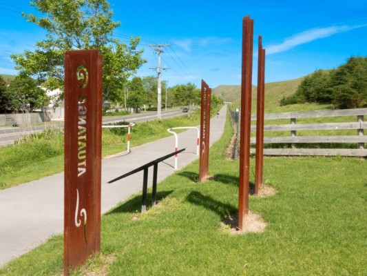
Near Heath Johnston Park, the cycle and walkway crosses land gifted to the people of Gisborne by Matuaokore Ahu Whenua Trust. Four pou tell a story of the values the landowners wish to maintain into the future - unity and support (Manaakitanga), guardianship (Kaitiakitanga), family and belonging (Whanaungatanga), all bound together by their spiritual beliefs (Atuatanga).
Kaiti School, established in 1907, champions active ways of children getting to and from school.
Crawford Road was named after Gisborne’s first Mayor William Crawford, elected in 1877. He was also a brewer and keen photographer. His collection of photographs from 1874 until 1913 chronicles the district. A selection of these can be found within the book Gisborne Exposed, by Sheila Robinson and John Berry.
Near the working port, the trail passes a large yard of logs, mainly destined for China. These originate from significant forest holdings within the district and reflect the region's changing land use over the past 150 years from native bush to sheep and beef farms, and to pine trees. Logs now occupy much of the area next to the port where a freezing works operated for close to a century. This closed in 1994 as livestock numbers, particularly sheep, declined on the coast and across the country. Some freezing works buildings remain including The Works, now a restaurant and office spaces.
A large anchor sited within the Inner Harbour remains as a symbol of this working port. Restaurants and cafes have replaced fishing and wool stores.
The trail ends on the city side of Gladstone Road Bridge in Gladstone Road, Gisborne's main street. But many other trails connect from there, notably the Oneroa and Ngā Wai Weherua (City Rivers) trails. Gladstone Road Bridge, built in 1925, is one of New Zealand’s older reinforced-concrete bridges. A shared path was added to the bridge in 2018 making a separated and safe crossing for walkers and cyclists between the Inner Harbour and the city.
The port itself is a river port with a long history punctuated by environmental challenges. It's the base for the recreational Tatapouri Fishing Club. The Inner Harbour has berths and a boat ramp providing access to the ocean. Gisborne's Coastguard is based adjacent to a large and increasingly modernised export port.
The whole area was far different in pre-European times. For a glimpse of this, see the history section on the trail page Titirangi Cycle and Walkway.
Tips & Logistics
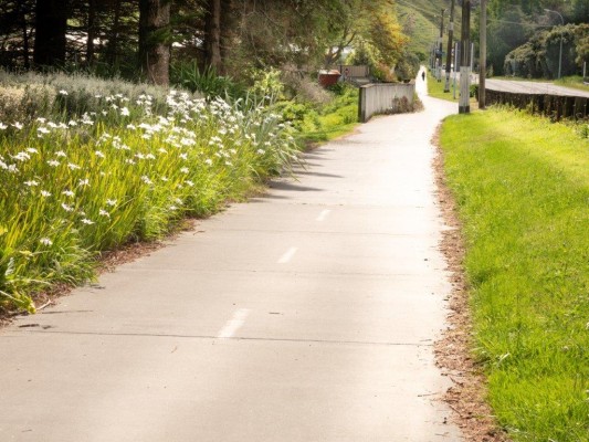
The trail can be started at either end. It comprises concrete or asphalt all the way. At the eastern end, it starts at the city side of Murphy Road close to Wainui Beach.
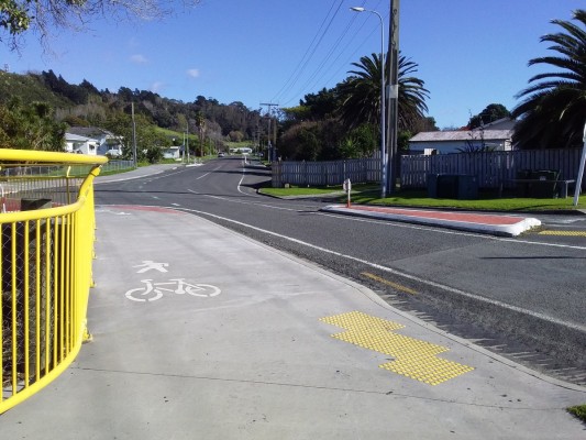
Take care crossing Murphy Road to avoid traffic coming in and out of Murphy Road, where vision of cyclists emerging from the trail is impaired. Cyclists are advised to stop, slow or dismount.
The beach can be accessed at various points, the closest to the end or start of the trail being Stock Route, just past a cafe. This access has a parking area just where Wairere Road turns to be parallel with the beach.
At the Gladstone Road Bridge end, a path leads down to either the Oneroa or Ngā Wai Weherua (City Rivers) trails. These trails are shared with a full range of active mode users.
Titirangi Cycle and Walkway is also nearby, starting at the Te Poho o Rawiri Marae close to Crawford Road. Titirangi's bush walk trails have a starting place close to the port but are also accessible from the road trail starting at the marae.