Grade
HillyDistance
4km loopWalking
40 minCycling
20 minRoad condition
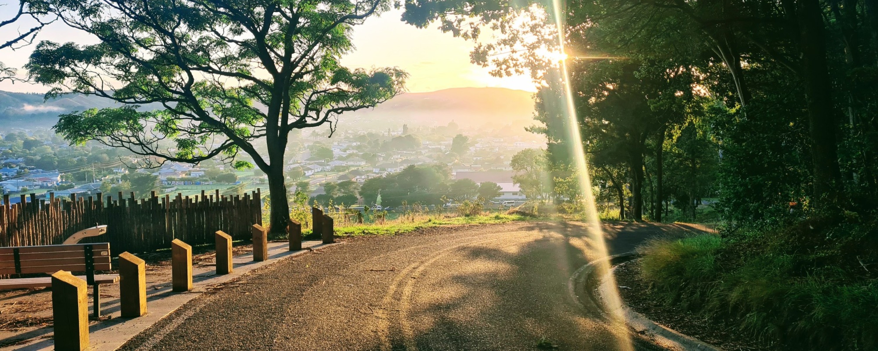
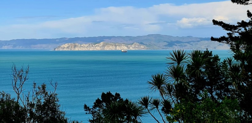
Titirangi is a 35ha reserve with extensive views of the bay, port, city and three rivers.
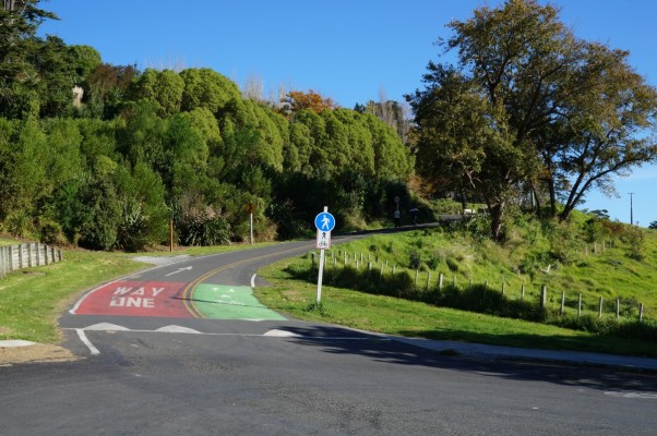
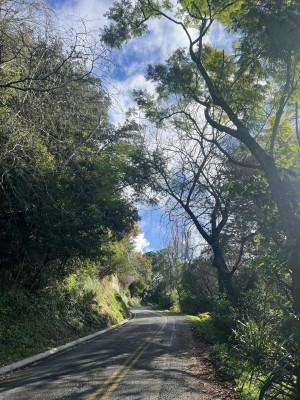
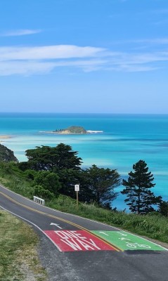
The bush and tree-clad walking and cycling route goes from Te Poho o Rawiri Marae along Queens Drive over the top of Titirangi and down Titirangi Drive and Endcliffe Road to Ranfurly Street back to the marae. The road is two-way for people walking and cycling, but one-way for cars (ascending the hill following Queens Drive).
Titirangi is a much-visited attraction, locals often taking their visitors to the top to show them a bird’s eye view of the city and environs. This is also a great place to watch the sun rise, Gisborne being the first city in the world to see the sun rise … and set.
Titirangi is one of the most popular walks in the city, especially when the Titirangi/Everest challenge is on in the spring. Numerous bush walks on Titirangi Reserve are covered in a separate trail page, Titirangi Bush Walks.
(Thank you to Paul Lee for the image at the top of this page.)
Trail fly-through
History of the trail
A community icon, Titirangi is full of history. Māori from the area describe Titirangi as their maunga (mountain) when reciting their personal pepeha. The people of Ngāti Oneone are guardians of the reserve.
From the time of the first arrival of Māori in the waka (canoe) Takitimu, Titirangi was the name given to the area as it resembled a hill in their faraway homelands. Titirangi became home to generations of new arrivals as further waka landed on the shore below. The hill’s natural aspects created buffers to repel invaders. Its surrounding lands were ideal for growing food.
The area is also known as Kaiti Hill, in reference to the suburb of Kaiti it lies within.
The reserve is close to where the first Europeans set foot on land in Aotearoa New Zealand. Some of this history can be found at the Puhi Kai Iti/Cook Landing Site National Historic Reserve between Titirangi Reserve and the port. This commemorates the first landing place of James Cook in October 1769, after arriving on the HMS Endeavour, and commemorates the Horouta and Te Ikaroa-a-Rauru waka (canoes), which carried Māori to the district.
Te Poho o Rawiri Marae is the tribal heart of Ngāti Oneone. Situated at the foot of Titirangi/Kaiti Hill, it was reputed to be the largest carved meeting house in New Zealand when it opened in 1930. Iwi and hapū throughout the Tairāwhiti district made financial contributions to the meeting house, the third in the vicinity of Gisborne’s port to bear the name. The first was built by Hirini Te Kani a Takirau after the death in 1852 of his father Te Eke Tu o Te Rangi who signed the Treaty of Waitangi. It was sited in the area of the present inner harbour, towards the edge of the Tūranganui River. After converting to Christianity following the signing of the Treaty, Te Eke took the Biblical name of Rawiri (David), hence the name of the marae.
By the 1880s the house was becoming uninhabitable. The second house was built about 1890 on the same marae site situated in Hirini Street opposite the cemetery and was in use until the site was required for harbour extensions in the late 1920s. Land was taken under the Public Works Act to excavate the inner harbour and plans made to rebuild Te Poho o Rawiri on its present site.
The dining hall Te Poho o Hine i Tuhia was built first and opened in 1929, then the meeting house opened in 1930 and the church Te Toko Toru Tapu in 1935. Some carvings from the earlier house are in the Tairāwhiti Museum.
Te Poho o Rawiri is one of the few marae built by an Act of Parliament. It was the first meeting house to have a steel ridge pole. The richly decorated interior incorporates interior alcoves and a stage – features considered quite radical at the time. The stage is framed by carved maihi with a koruru at the apex, making a meeting house within a meeting house. The carving was undertaken at the Māori school of art in Rotorua. The tekoteko at the apex of the front barge boards, a human figure kneeling on the right knee with the right hand held upwards, represents Ngāti Oneone ancestor Rawiri Te Eke Tu o Te Rangi.
In 2018, the marae undertook a major restoration, with a new dining hall capable of catering for 1000 people at a time.
Tips & Logistics
The trail starts on Queens Drive by Te Poho o Rawiri Marae and follows the road up to the summit and over the other side. Vehicles must travel only one way from the marae up the hill to return via Endcliffe Road and Ranfurly Street.
If you are cycling, take extra care when descending from the summit, in either direction. Watch out on blind corners for walkers coming up the hill, judder bars, and unfavourable road conditions including slumps and potholes.
The route is close to other prominent Gisborne trails, including the Wainui-Tamarau Trail, and the Oneroa and Ngā Wai Weherua (City Rivers) trails.
Walkers can turn around at any point and return to their start. The walking lane is marked on the road. Or follow the many tracks flowing off the road (see separate trails page). These will appeal to those wanting to see more bush, take steeper climbs or discover more links to history.